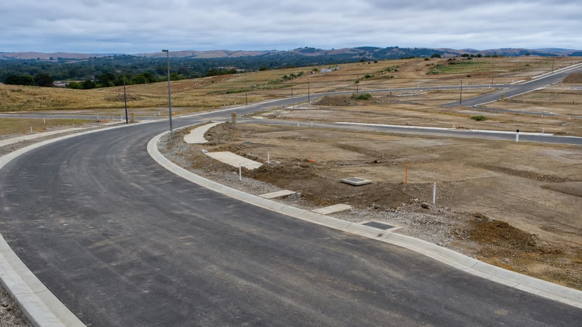
 Photo: SiteLogic editorial image
planning
Clause 56 ResCode: subdivision layout and street network
How Clause 56's street, lot and open space requirements reduce net developable area on a Victorian residential subdivision, and what the Subdivision Act adds on top.
What applies
Clause 56 governs the subdivision of residential land in Victoria and sits alongside Clause 55 rather than replacing it. Where Clause 55 tests the built form of dwellings, Clause 56 tests the underlying subdivision pattern: the lots, the streets, the open space and the servicing that a development sits on before a single dwelling is designed.
The clause opens at 56.01 with an application requirement rather than a numeric standard. An applicant has to prepare a subdivision site and context description covering the site's dimensions and orientation, levels, natural features, existing buildings, access points and easements, and, for larger subdivisions, the surrounding pattern of subdivision, land use and movement network. That description then has to be answered by a design response explaining how the proposed layout derives from it and meets the relevant objectives of Clause 56. From there the clause runs through a sequence of modules: 56.02 policy implementation, 56.03 liveable and sustainable communities, 56.04 lot design, 56.05 urban landscape, 56.06 access and mobility management, 56.07 integrated water management, 56.08 site management and 56.09 utilities.
Two of those modules do most of the commercial work. Lot design, at 56.04, sets objectives and standards for the mix of lot sizes, the minimum building envelope a lot has to be able to contain, solar orientation and street orientation. Access and mobility management, at 56.06, requires the subdivision layout to address the walking and cycling network, the public transport network and the neighbourhood street network as a connected system, and it attaches a detailed table of street types, from access lanes through to arterial roads, each with its own indicative traffic volume, target speed, carriageway width, verge width and footpath provision.
How to model it
The commercial consequence of Clause 56 is straightforward to state and easy to get wrong in a spreadsheet: gross site area is not net developable area, and the gap between the two is set by the standards in this clause, not by guesswork. Every metre of road reservation, verge and footpath the street network standard calls for comes out of the land available for saleable lots. The lot design standards then set a floor under how small a lot's building envelope can be before it stops being a genuinely developable lot rather than a line on a plan.
Model the street network first, because it is the layer that determines how the rest of the site is cut up. The access and mobility standards expect a layout that connects to the existing walking, cycling, public transport and street network rather than a self-contained pod, and the accompanying table sets out street types by function, from a narrow rear access lane principally serving parking, through access places and access streets, up to connector streets and arterial roads. Each type in the table carries its own reservation and verge expectations, and a subdivision that relies heavily on higher-order street types, or that needs a wider verge to accommodate integrated water management and street tree planting, will return less net developable area than one that can be served mostly by narrower access lanes and places.
Lot design then constrains what can be built on what remains. The lot area and building envelope standard expects smaller lots to demonstrate that a dwelling can actually be built within the requirements of the scheme, and larger lots to be able to contain a defined minimum rectangle, so a subdivision cannot simply chase the smallest possible average lot size without proving each lot can carry a compliant dwelling. Solar orientation and street orientation standards then push the layout toward particular lot proportions and street-facing arrangements, which interacts with how efficiently a given block can be cut into lots at all.
The Subdivision Act layer
Clause 56 governs what a planning permit for subdivision has to demonstrate. It does not replace the separate legal process that turns an approved layout into registered lots. The Subdivision Act 1988 is the Victorian legislation that governs plans of subdivision themselves: how a plan is certified and registered, how a subdivision can be staged, how easements and restrictions are created or removed, and how common property and owners corporations are established where a development shares land or infrastructure across lots.
The Act also gives a council the power to require land, or a payment in lieu, to be set aside for public open space as a condition of consent to a subdivision. The proportion or method a council applies is set locally and can vary between municipalities and over time, so it should be confirmed with the relevant council rather than assumed from a rule of thumb, and treated as a further reduction against net developable area rather than an afterthought once lot yield has already been fixed.
The following figures are illustrative. They demonstrate the method and will vary by site, council and timing. Take a hypothetical one-hectare infill site being cut into standard residential lots. After allowing for an internal access street and its verges under the relevant street type in Table C1, and after setting aside land for a public open space contribution and a modest area for services and easements, the land actually available for saleable lots can end up meaningfully below the gross site area, sometimes by a fifth or more depending on how much of the internal network needs to be a higher-order street type rather than a narrow access lane. A feasibility that treats gross site area as a proxy for saleable land will overstate yield before a single dwelling design is drawn.
What to check before exchange
Confirm the subdivision site and context description and design response requirements at 56.01 have actually been addressed for the specific lot count proposed, since the level of detail required scales up once an application proposes three or more lots, and again at sixty or more lots. A responsible authority does not have to give notice of, or decide, an application until it is satisfied this description is adequate, so an incomplete description is a programme risk as much as a design one.
Test the street network layout against the access and mobility standards and the accompanying street type table early, ideally with a civil engineer rather than relying on a concept plan alone, since reservation width, verge width and footpath requirements vary materially between street types and directly reduce net developable area. Check the lot design standards against the actual lots proposed, not just an average lot size across the whole subdivision, to confirm each lot can contain a compliant building envelope once setbacks, solar orientation and street orientation are applied.
Finally, obtain a civil engineering opinion on the achievable net developable area rather than relying on a desktop lot count, confirm the council's current public open space contribution requirement and method for the specific site, and check whether a staged subdivision strategy is compatible with how the Subdivision Act's registration process for staged plans actually works for the number of stages proposed.
Published by the SiteLogic Editorial desk. Every fact traces to a primary source. See our standards and corrections register.
Fact-checked: 19 July 2026 · Review by: 19 July 2027
Sources: planning-schemes.app.planning.vic.gov.au · legislation.vic.gov.au
Was this useful? Try the tool this post is based on:
Pro on SiteLogic. Logi: up to 60 messages a day. Logi also stops at US$15 of model cost in a Melbourne calendar month. The Developer Comms Kit and unlimited saved projects. The Strategy Lab simulator runs without Pro. Saving a scenario needs a signed-in account. $60/month or $600/year, ex GST. First 3 months are $30/month, ex GST, on monthly Pro.