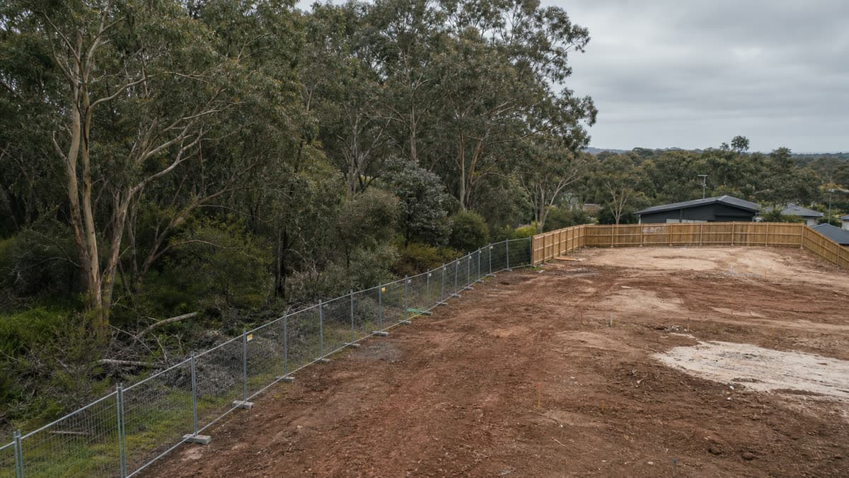
 Photo: SiteLogic editorial image
Native Vegetation
Clause 52.17 native vegetation: offset risk before layout
How Victoria's native vegetation permit trigger, assessment pathways and offset evidence affect site planning before a layout is treated as settled.
Native vegetation is often treated as a late ecology item. In a Victorian development model, that is too relaxed. Clause 52.17 can move a tree line, remnant patch or mapped wetland from background context into the planning permit path, and DEECA's offset rules can turn that path into a cost and timing item before the first layout is settled.
The commercial point is simple. If the site plan assumes removal before the permit trigger, assessment pathway and offset evidence are checked, the yield may be cleaner on paper than it is in the planning file.
What changed
The current Victorian framework still starts with a broad permit rule. Clause 52.17 requires a permit to remove, destroy or lop native vegetation, including dead native vegetation, unless an exemption or schedule provision applies. DEECA's native vegetation removal regulations page describes the same system as one primarily implemented through local council planning schemes.
The regulations were updated on 12 December 2017. DEECA says the Guidelines for the removal, destruction or lopping of native vegetation explain how removal is assessed and offset, and that those Guidelines are an incorporated document in Victorian planning schemes.
For feasibility work, the important change is not a single new rate or levy. It is the way the native vegetation question has to be sequenced. The layout, arborist review, ecological survey and offset evidence need to speak to each other before a proponent treats a developable area as fixed.
What applies
DEECA defines native vegetation as plants indigenous to Victoria, including trees, shrubs, herbs and grasses. The planning question is whether the proposal removes, destroys or lops that vegetation and whether an exemption applies.
DEECA's exemptions guidance says a permit is required unless the removal is not regulated by the planning scheme or the planning scheme provides for removal without a permit. It also notes three broad circumstances where a permit may not be required: lawful existing use rights, an exemption under Clause 52.16 or Clause 52.17, or native vegetation listed in a schedule to Clause 52.17 in the relevant planning scheme.
That makes local checking essential. A purchaser cannot rely on the existence of native vegetation alone, or on a general impression that the site is small or already disturbed. The responsible authority will look at the planning scheme controls, the exemption wording, the schedule and the proposal's actual works.
DEECA also says application requirements depend on the assessment pathway. The pathway is determined by the amount of native vegetation to be removed, whether any large trees are to be removed and the location of the vegetation in the landscape. The three pathways are Basic, Intermediate and Detailed.
How to model it
A feasibility model should separate three questions.
First, identify the affected vegetation. The model needs enough early technical input to distinguish a remnant patch, scattered tree, large tree or mapped wetland from general landscape planting. This reaches past design. It controls whether the layout is exposing the project to an application requirement, a site assessment or an offset requirement.
Second, test avoidance before offset. DEECA's biodiversity information page says its tools and maps are used to decide where to focus efforts to avoid and minimise impacts from native vegetation removal, assess impacts when removal is proposed, and determine the biodiversity improvements delivered by offsets. In practice, this means the project team should test whether a driveway, building footprint or service route can move before assuming removal is the base case.
Third, price the approval path as stages. A Basic pathway site may only need a narrower evidence package. A Detailed pathway application can require a site assessment, including habitat hectare assessment of patches, tree location and species details, and large tree circumference measured at 1.3 metres above ground level. DEECA says Detailed pathway site assessments must be completed by an accredited native vegetation assessor.
The official sources do not support a standard dollar allowance for offsets. They do support a staged allowance for advice, mapping, assessment, design changes, permit evidence and, if needed, offset purchase or first-party offset establishment.
Offset risk
Offsets are not a closing formality. DEECA says planning permit applicants must include an offset statement in their application, and that the statement must provide evidence that a suitable offset exists and can be secured.
DEECA identifies two ways to secure an offset: buy a native vegetation credit from a third party or establish a first-party offset site. For third-party credits, DEECA points applicants to the Native Vegetation Credit Register search tool and says registered brokers can help complete and submit the paperwork. DEECA also maintains information about traded credits so applicants can understand potential purchase costs.
That turns offset availability into a diligence question. A project may be technically capable of offsetting removal, but the relevant credit type, location attributes and market price can still affect the purchase model. Where the project relies on a first-party offset, the model also needs to consider management obligations, land set aside and the time needed to confirm eligibility.
What to check before exchange
Start with the planning scheme. Confirm whether Clause 52.17 applies to the land and whether any schedule lists vegetation that can be removed without a permit. Then check whether an exemption is genuinely available for the proposed works, not merely for a different maintenance activity.
Map the proposed development footprint against all native vegetation that may be affected by removal, lopping, access works, services, drainage, construction zones and defendable space. A layout that protects the building pad but removes vegetation for a crossover may still need assessment.
Confirm the likely assessment pathway before relying on a yield. If the pathway is Detailed, allow for an accredited native vegetation assessor and enough programme time for the report, permit material and any design response.
Ask whether the permit application will need an offset statement. If yes, request evidence that a suitable offset exists and can be secured. Treat the offset price, broker process or first-party offset work as a separate feasibility line rather than an unpriced condition.
Finally, keep the native vegetation check current. A site plan, survey or council pre-application comment can become stale if the design changes. Before exchange, the useful question goes beyond whether vegetation exists. It is whether the layout has already absorbed the permit trigger, evidence package and offset path that follow from removing it.
Fact-checked: 20 June 2026 · Review by: 20 June 2027
Sources: planning-schemes.app.planning.vic.gov.au · environment.vic.gov.au · environment.vic.gov.au · environment.vic.gov.au · environment.vic.gov.au
Was this useful? Try the tool this post is based on:
Pro on SiteLogic. Logi: up to 60 messages a day. Logi also stops at US$15 of model cost in a Melbourne calendar month. The Developer Comms Kit and unlimited saved projects. The Strategy Lab simulator runs without Pro. Saving a scenario needs a signed-in account. $60/month or $600/year, ex GST. First 3 months are $30/month, ex GST, on monthly Pro.